|
Titelbeschreibung
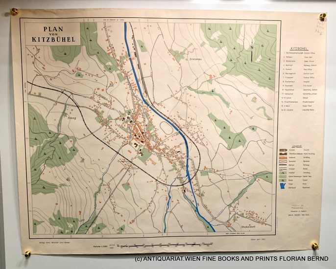
KITZB?HEL MAP Date: 1952 / Plan von Kitzb?hel 1952 Linz, Hans Wimmer / C. und. E. Grosser, 1952. original Stadtplan / Umgebungskarte, Mehrfarbendruck, Kartenlegende am rechten Rand mit Nummer und Kartenzeichen, Ma?stab 1:5000 , Zustand: sehr gut, very good, Veros weiss / blank. 68 x 54 cm Gro?formatiger seltener Plan der Gemeinde Kitzb?hel in Tirol aus den fr?hen 1950er Jahren. Eingezeichnete und in der Legende bezeichnete Objekte: 1 Bezirkshauptmannschaft 2. Rathaus 3. Gendarmerie 4. Bahnhof 5 Postamt 6. Bezirksgericht 7. Finanzamt 8. Krankenhaus 9. Feuerwehr 10. Hauptschule 11. -13. Schule 14. Privat Krankenhaus 15. E Werk 16.-22. Industrie // Large rare map of the municipality of Kitzb?hel in Tyrol from the early 1950s. Objects marked and indicated in the legend: 1. district administration 2. town hall 3. police 4. railway station 5. post office 6. district court 7. tax office 8. hospital 9. fire brigade 10. secondary school 11. -13. school 14. private hospital 15. Power plant 16.-22. Industry / old original map from 1952.
Anbieter: Bestellnummer: A111-566 Versandkosten: Auf Anfrage
→ In den Warenkorb |
|||
![]()
![]()
Nach oben
- Startseite
- Kontakt
- AGB
- Datenschutz
- Impressum
- Newsletter
- Links
(c) Copyright 2004-2025 by GIAQ - Alle Rechte vorbehalten